Phil Stooke, of the University of Western Ontario (now retired), is the author of two terrific reference works for Mars missions: The International Atlas of Mars Exploration: The First Five Decades, and The International Atlas of Mars Exploration: From Spirit to Curiosity. In the second volume, he thoroughly documents the routes of the rovers on a base map of HiRISE images, marking the sol numbers for each stop and listing every target examined in each location. The second volume ends at the end of Curiosity’s prime mission in mid-2014, but he has continued to post updated maps at unmannedspaceflight.com since. Here are his route maps, in order, updated as of 8 October 2020 to sol 2824. The last few maps will probably be replaced soon with better versions.
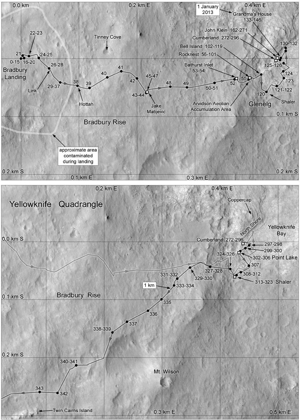
Map 1: sols 0 to 343: Bradbury Landing and Yellowknife Bay
John Klein and Cumberland drill sites; Yellowknife Quadrangle
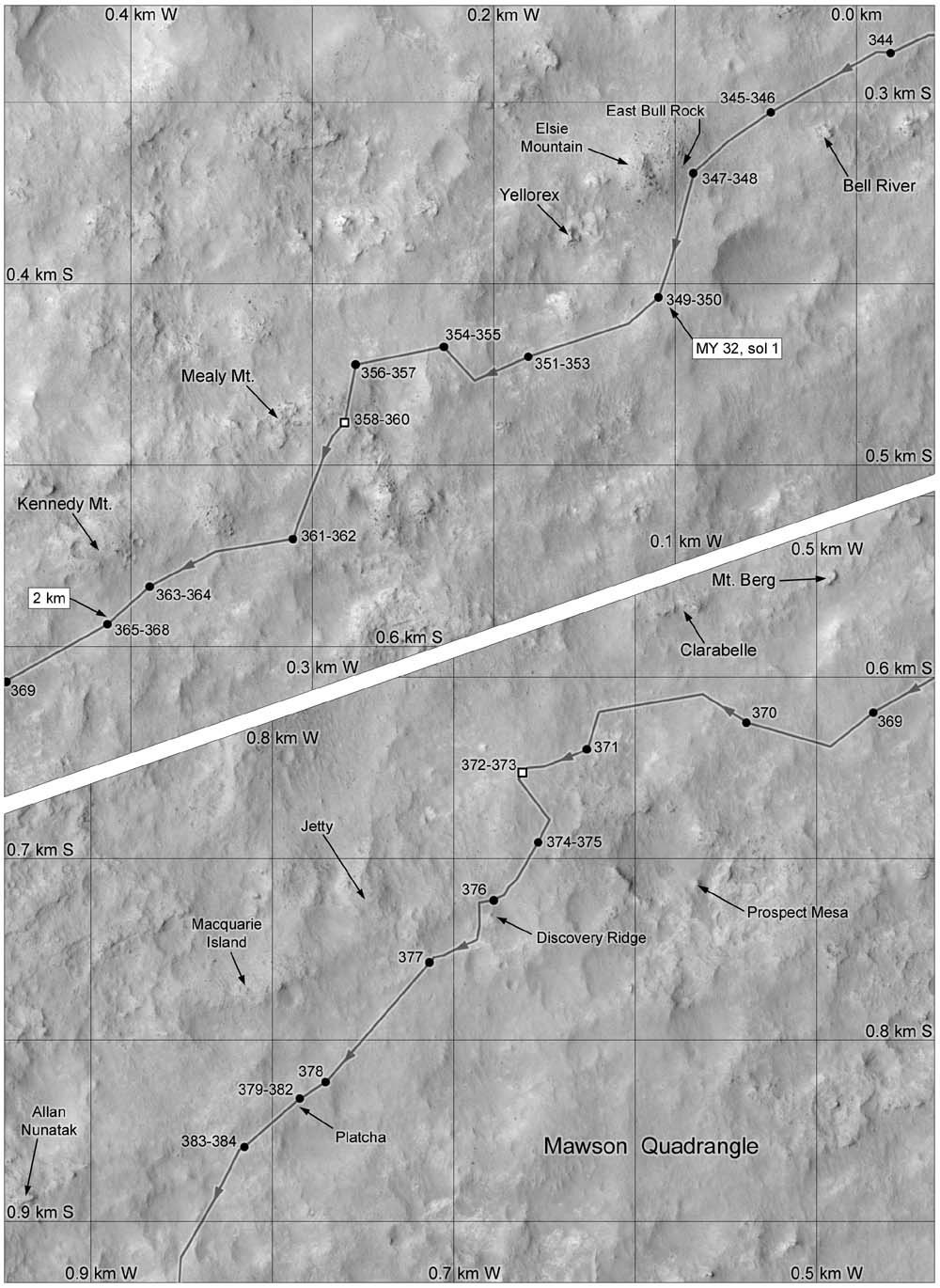
Map 2: sols 344 to 384: Bell River to Allan Nunatak
No drill sites; Mawson Quadrangle
Map 3: sols 385 to 423: Panorama Point
No drill sites; Kimberley Quadrangle
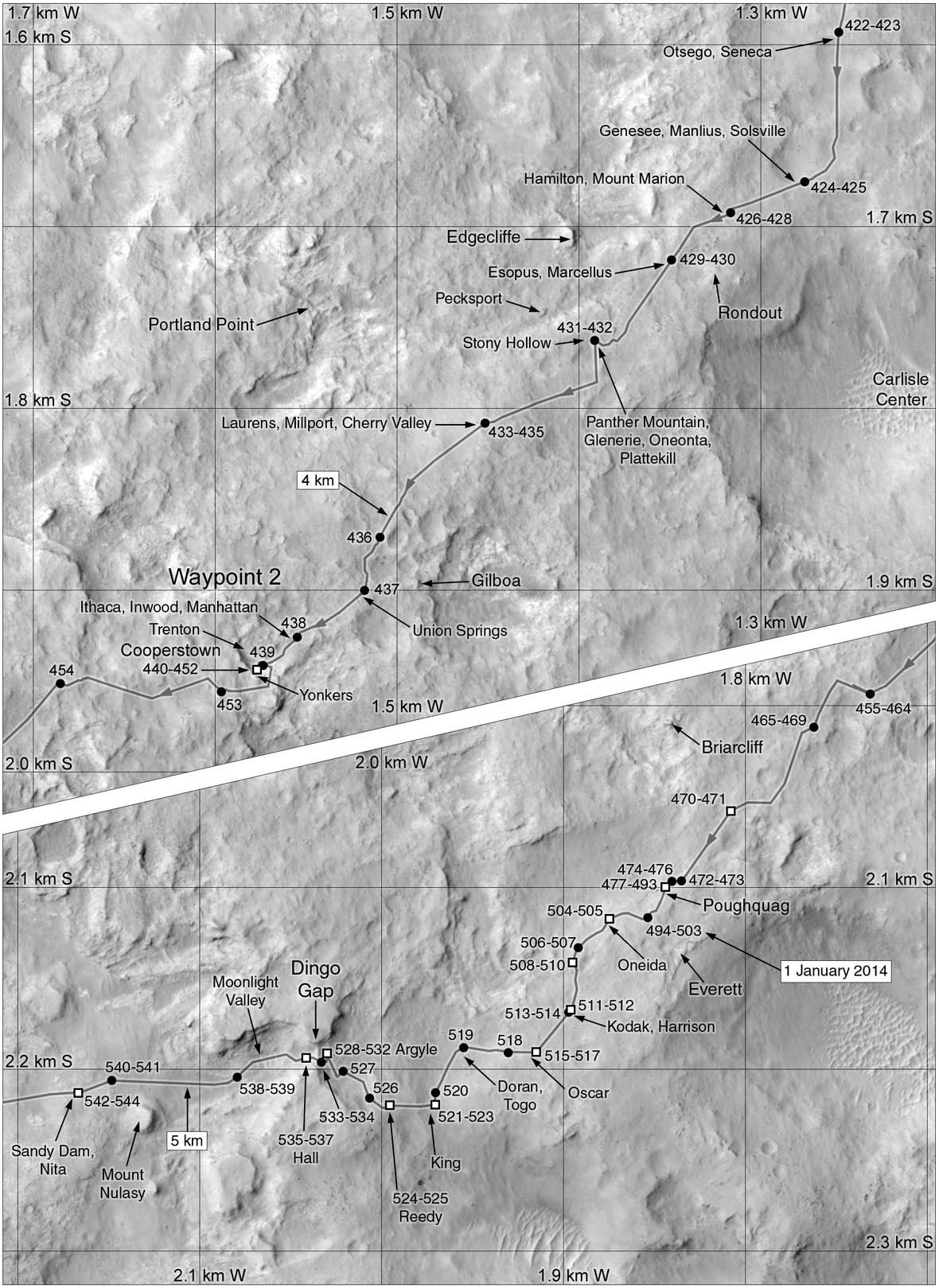
Map 4: sols 423 to 544: through Dingo Gap
No drill sites; Kimberley Quadrangle
Map 5: sols 540 to 629: Junda, Kylie, and Kimberley
Windjana drill site; Kimberley and Hanover Quadrangles
Map 6: sols 603 to 669: Windjana and Robert Frost Pass
Windjana drill site; Hanover Quadrangle
Map 7: sols 668 to 744: Zabriskie Plateau
Bonanza King drill site; Shoshone Quadrangle
Map 8: sols 743 to 1071: Pahrump Hills
Confidence Hills, Mojave, Pink Cliffs, Telegraph Peak, and Buckskin drill sites; Arlee and Shoshone Quadrangles
Map 9: sols 974 to 1192: Marias Pass to Bagnold Dunes
Buckskin, Big Sky, and Greenhorn drill sites; Arlee and Windhoek Quadrangles
Map 10: sols 1192 to 1400: Bagnold Dunes and Naukluft Plateau
Gobabeb scoop site; Lubango, Okoruso, and Oudam drill sites; Windhoek Quadrangle
Map 11: sols 1400 to 1467: Murray Buttes
Marimba and Quela drill sites; Windhoek Quadrangle
Map 12: sols 1468 to 1576: South of Murray Buttes
Sebina and Precipice drill sites; Windhoek and Bar Harbor Quadrangles
Map 13: sols 1576 to 1607: Ireson Hill, Ogunquit Beach and southern Bagnold dunefield
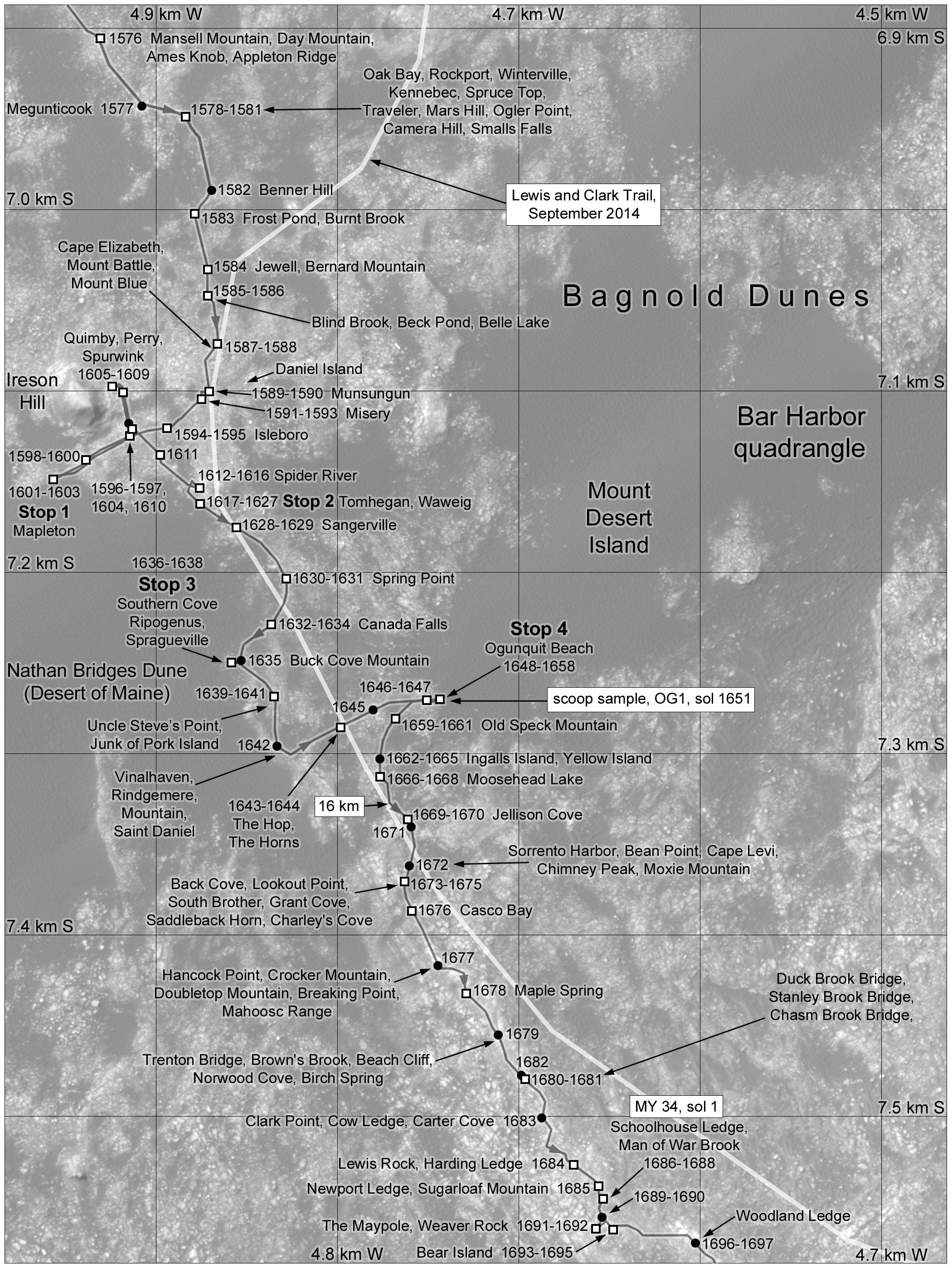
Ogunquit Beach scoop sample; Bar Harbor Quadrangle
Map 14: sols 1606 to 1870: Along the Base of Vera Rubin Ridge
No drill sites; Bar Harbor and Kuruman Quadrangles
Map 16: sols 2053 to 2617: Vera Rubin Ridge and Beyond
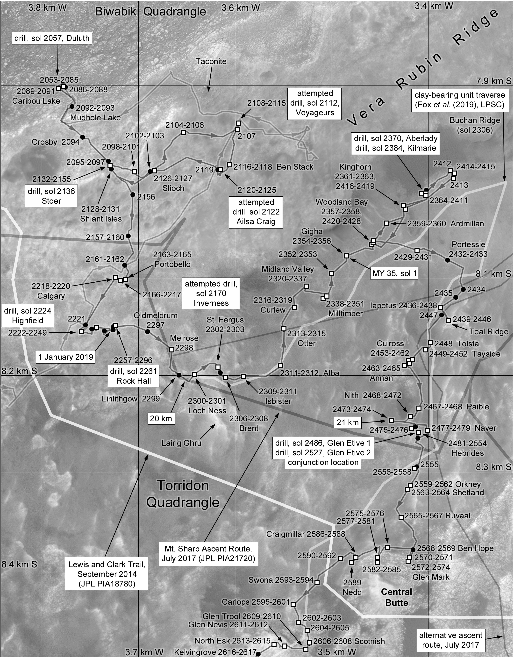
Duluth, Voyageurs, Ailsa Craig, Stoer, Inverness, Highfield, Rock Hall, Aberlady, Kilmarie, and Glen Etive drill sites; Biwabik and Torridon Quadrangles
Map 17: sols 2555 to 2632: Glen Torridon, Central and Western Buttes
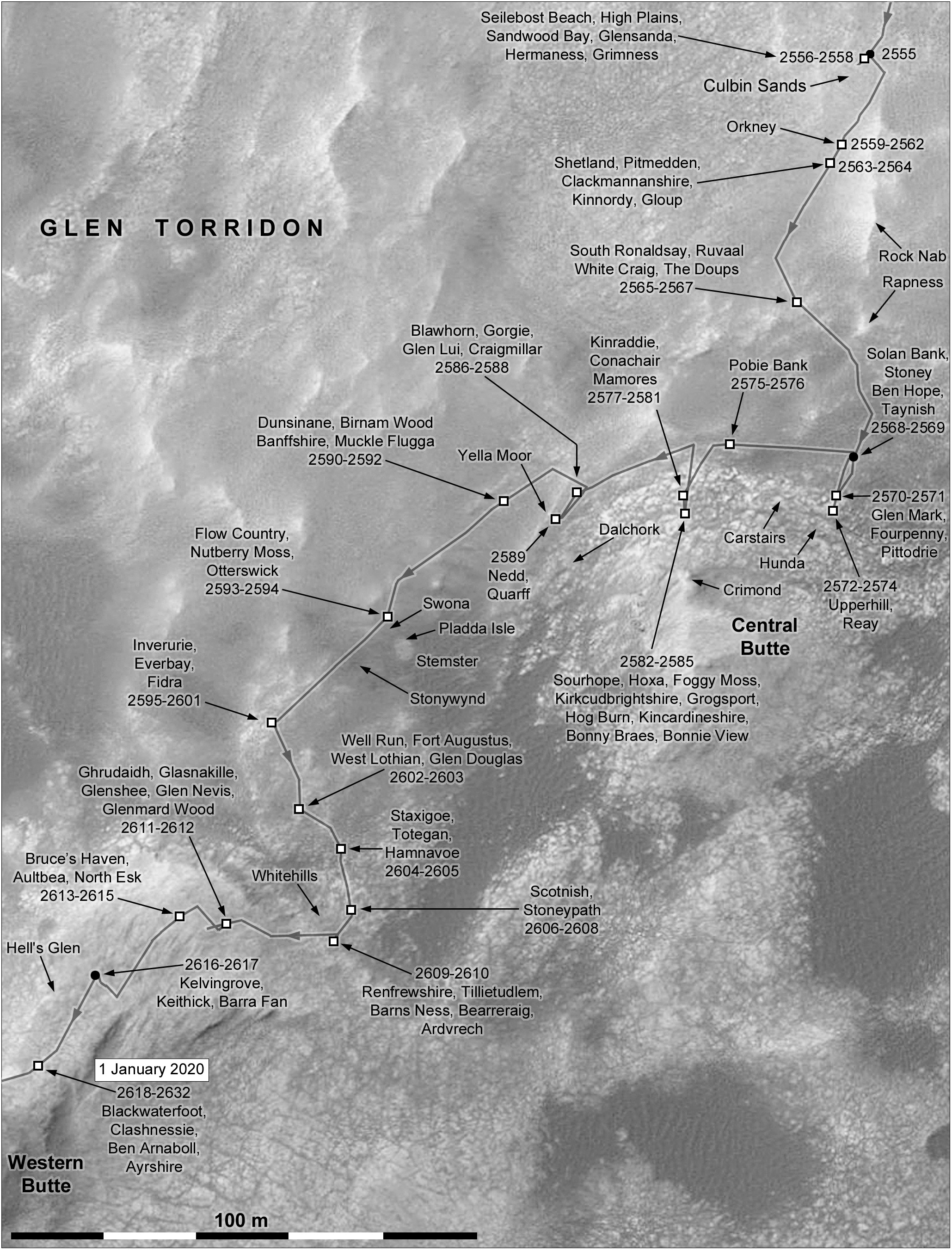
No drill sites; Torridon Quadrangle
Map 18: sols 2616 to 2903: Greenheugh Pediment, Tower Butte, and final Glen Torridon drill sites
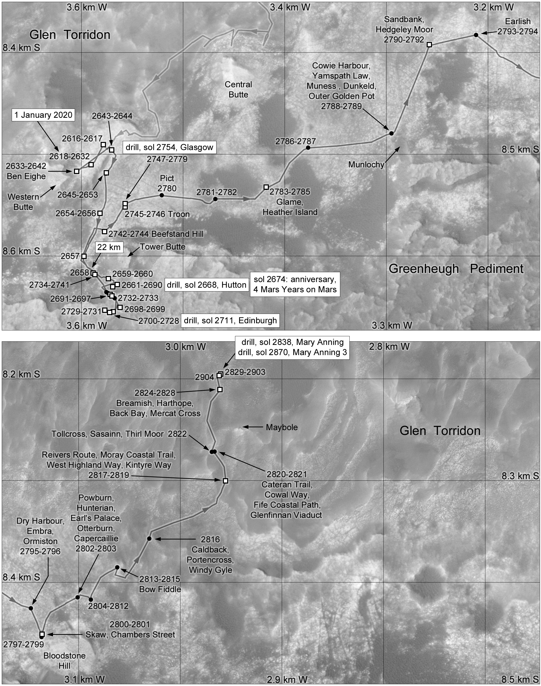
Glasgow, Hutton, Edinburgh, and Mary Anning drill sites; Torridon Quadrangle